Length: 5.5 km
Difference in altitude: 240 mt
Travel time (hours): 1:35
Suitable for: Everyone
Trail description
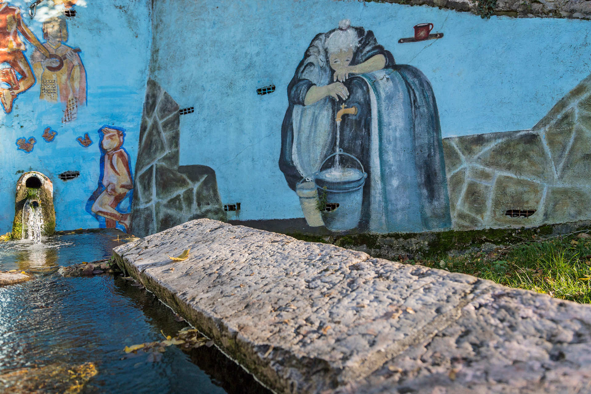
The trail starts in the parking lot, on the side of Azzago's parish church, and climbs up the paved road to Vallene; right before the hairpin turn, turn right along a narrow road to climb up from Vallene to Cerzuni. There are several popular religious artefacts along the road, while right below Cerzuni, the nice and recently renovated wash house is worthy of a visit.
The paved road uphill ends on a crossroad, where you can notice an ancient 18th century stone sculpture. Continue right on the dirt road until you reach a new crossroad, also with a stone pillar on one side. From here, climb up the dirt/paved road, until you reach the Santa Viola church - a small and charming chapel, right below the mountain's peak. You can reach the peak by continuing along the dirt road and then on a small trail, leading in front of the recently renovated early 20th century fortress.
In the northern side of the fortress, covered by a bulky embankment, walk downhill along the forest road that crosses the entire pine tree woods, until you get back on the dirt road, near the Santa Viola chapel. The trail continues along the outward road, until you reach the crossroad on the ridge, then turn left and start flanking the mountain side, between nice meadows and amazing views over the San Rocco di Piegara ridge, and the Monte Comun ridge.
The descent ends on the paved crossroad toward Casale, after which you'll reach Monte Castello's northern junction. Keep the right to follow the CAI trail into the dense woods, which will take you back to Azzago. A few hundred meters on an uphill road will take you back at the bottom of the church's staircase. Climb it to reach the starting parking lot.
* At this crossroad trails D3 and D4 intersect; you can combine them, avoiding the La Croce / Romagnano path, for an overall length of 11,6km, an altitude difference of ± 340m and an average travel time of 3h20m.
Stages of the trail:: Church of Azzago (616m) - Vallene (670m) - Cerzuni (688m) - Monte Santa Viola junction (753m) - Santa Viola church (788m) - Forte Santa Viola (830m) - Monte Santa Viola junction (753m) - Monte Castello junction (661m) - Azzago (580m) - Church of Azzago (616m)
Warning: in order to use the map of the GPX file you need an external application downloadable from PlayStore or AppStore.


Follow Feet's signs
All trails are marked by signposts, trail poles indicating the path (sometimes with information stands) and message boards.
Orange indications refer to hiking trails, while light blue ones to biking trails.


Project financed in part with the contribution of Bim Adige
© FEET Comune di Grezzana. Tutti i diritti sono riservati | Privacy Policy | Cookie Policy
The textual and video-photographic materials are owned by the Municipality of Grezzana. Even partial reproduction is forbidden without prior authorization.