Length: 7.3 km
Difference in altitude: 300 mt
Travel time (hours): 2:15
Suitable for: Hikers
Trail description
This charming trail starts from Bellori, gets down on the provincial road for a short section, and gradually climbs up toward the valley floor districts of Dorighi, Spionca and Busa.
Behind Busa's buildings, you climb up a clear trail that, through a few hairpin bends, rapidly gains altitude, until joining the provincial road, on the junction on the hairpin bend, where you can continue toward Ceredo and Fosse, or toward Corso and Erbezzo.
Walking a few hundred meters on the paved road toward Ceredo, you will see a dirt road on the left. After taking this narrow road, you will be on the Madonnina trail, a charming section between Grezzana and Sant'Anna d'Alfaedo, which gradually climbs up the deep Valpantena canyon and its thriving stream. The trail includes wading the stream twice.
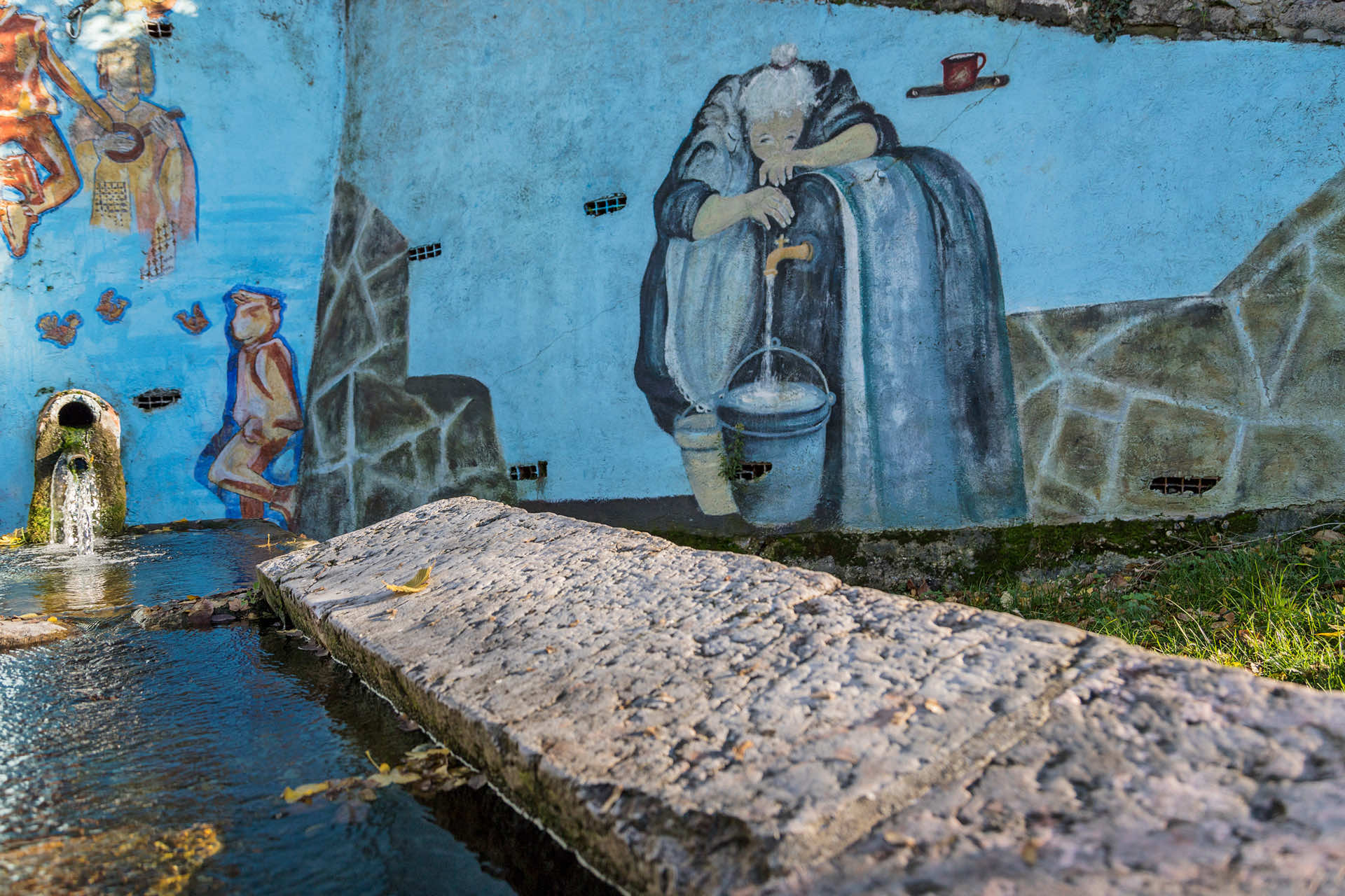
You will climb up the vaio near the Basasenoci bridge, but before reaching it, a few meters south, on the paved road, take the road up toward a county cart track, surrounded by a nice hornbeam and chestnut forest. The dirt road ends on Corso meadows and pastures, Grezzana's last northern district, with peculiar popular artworks, such as a tiny church, shrines and a nice local stone wash house, with a flourishing spring water source.
From Corso, continue along the paved road upstream of the town, turning right when you reach a small shrine, onto a dirt road, to reach the big scenic red chair, and, after a few hundred meters, another well-marked junction. Here, leave the trail to take the winding trail on the right, toward the provincial road; after two downhill hairpin turns, take the county trail on the left, to get back to the starting point in Bellori.
* This point crosses the B3 trail; from here, you can combine both trails proceeding towards La Rocca, Portello and Maioconi in order to get back on the path to Corso and Bellori. The total length of this variation barely exceeds 10km, with a height difference of ± 500m, and takes about 3h10min.
Stages of the trail:Bellori (340m) - Dorighi (355m) - Spionca (365m) - Busa (370m) - junction Ponte Basasenoci (485m) - Corso (590m) - Chiavara (525m) - Bellori (340m)
Warning: in order to use the map of the GPX file you need an external application downloadable from PlayStore or AppStore.


Follow Feet's signs
All trails are marked by signposts, trail poles indicating the path (sometimes with information stands) and message boards.
Orange indications refer to hiking trails, while light blue ones to biking trails.


Project financed in part with the contribution of Bim Adige
© FEET Comune di Grezzana. Tutti i diritti sono riservati | Privacy Policy | Cookie Policy
The textual and video-photographic materials are owned by the Municipality of Grezzana. Even partial reproduction is forbidden without prior authorization.